library(sf)
library(dplyr)
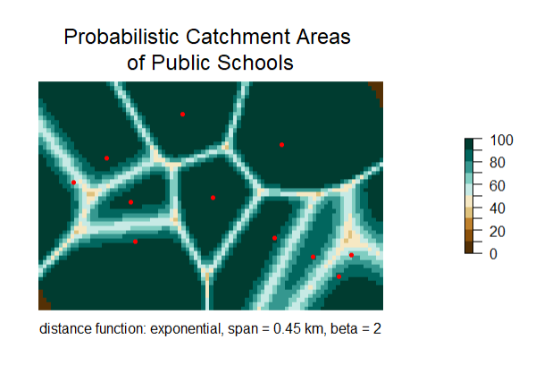
library(SpatialPosition)schools <- st_read("media/example_points.shp")convex_hull_amg <- st_convex_hull(schools)
convex_hull_buffered <- st_buffer(schools, dist = 500)matdist <- CreateDistMatrix(schools, mygrid, longlat = TRUE)#primarias\[ \text{Interaction} = \exp\left(-\alpha \cdot \text{mDistance}^{\beta}\right)\]
catchHuff <- huff(
  knownpts = puntos,
  unknownpts = mygrid,
  matdist = matdist,
  varname = "capacdd",
  typefct = "exponential",
  span = 450,
  beta = 2,
  returnclass = "sf",
  longlat = TRUE
)
rasterCatch <- rasterHuff(x = catchHuff)plotHuff(x = rasterCatch)
plot(st_geometry(primarias), pch = 20, col = "red", add = TRUE)
mtext("Probabilistic Catchment Areas \nof Public Schools",
side = 3,cex = 1.5, line=0.5)
mtext(text = "distance function: exponential, span = 0.45 km, beta = 2",
side = 1, line = 0.5)